Update on the Threat for Severe Storms Tuesday and Wednesday
April 25, 2023
Today’s weather pattern remains unsettled, and there is some potential for strong to severe thunderstorms to develop across the region. Should storms develop, they will most likely occur sometime after 6 pm, and not so much during the mid to late afternoon.
Forecasters are currently monitoring a small wave of low pressure located over northeastern Mexico that is tracking to the east. This system is predicted to move across the Hill Country and Central Texas regions late this afternoon and evening, causing our atmosphere to become increasingly unstable. However, today’s analysis shows a fairly strong stable layer in the middle atmosphere in place that is helping to limit the development of thunderstorms. This stable layer is forecast to remain tough through late afternoon, holding off most of the thunderstorm development. However, some of the high-resolution forecast solutions indicate the cap may erode sometime late this afternoon or evening, allowing for a rapid development of scattered strong to severe thunderstorms anywhere from the Hill Country, to the middle Texas coast.
The Storm Prediction Center has placed most of the Hill Country and all of Central Texas, along with Colorado and Wharton Counties under a Slight Risk, or a 2 out of 5 risk, for severe thunderstorms this afternoon through tonight. The primary severe weather threat will be large to very large hail, with a somewhat lesser potential for damaging downburst winds and isolated tornadoes.
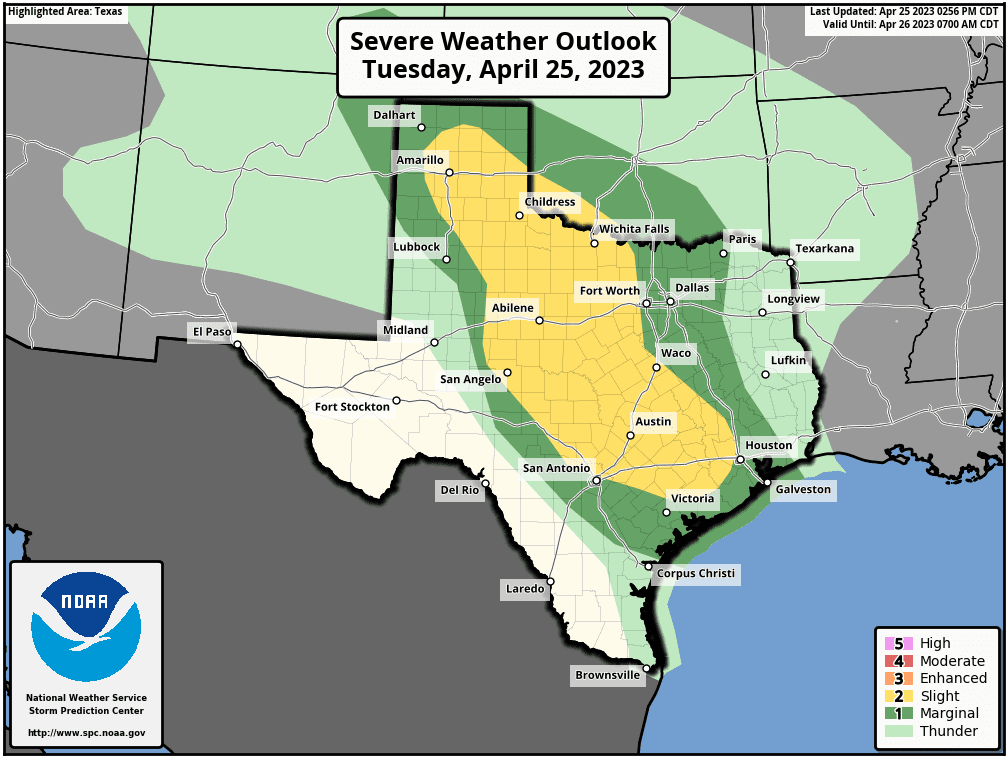
The probability for thunderstorm development this afternoon will be around 30 percent. The probability for thunderstorms will increase to 50-60 percent this evening, continuing till around midnight. Rain amounts are predicted to average between 0.25 and 0.5 inches, with isolated totals of 1-2 inches possible.
Another threat for strong to severe thunderstorms is forecast to take shape sometime Wednesday evening into Wednesday night when a cold front pushes south out of Northwest Texas. Forecasts indicate the greatest threat for severe weather will be across North Texas, extending south to around the Austin area, plus the northern Hill Country and the Big Country. The Storm Prediction Center has placed this general area under a Slight Risk, or a 2 out of 5 risk, for severe thunderstorms through Wednesday night. Much of the Hill Country, Central Texas, and the middle Texas coast has been placed under a Marginal Risk for severe storms. The primary severe weather threat will be large hail. The threat for severe storms will be somewhat less for areas west and southeast of Austin as the storms move into a more stable atmosphere.
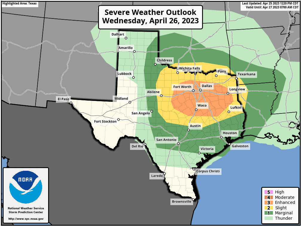
Rain amounts Wednesday night through early Thursday morning are forecast to again average between 0.25 and 0.5 inches, with isolated heavier totals.
Mostly sunny and dry weather is forecast beginning midday Thursday, with dry conditions continuing through midday Friday.
Bob
Social Media