Key Messages
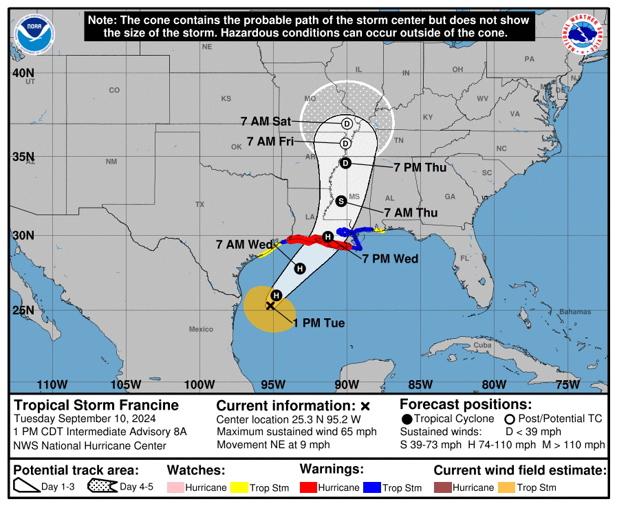
- The 10 am NHC forecast track for Francine has shifted a bit more to the east
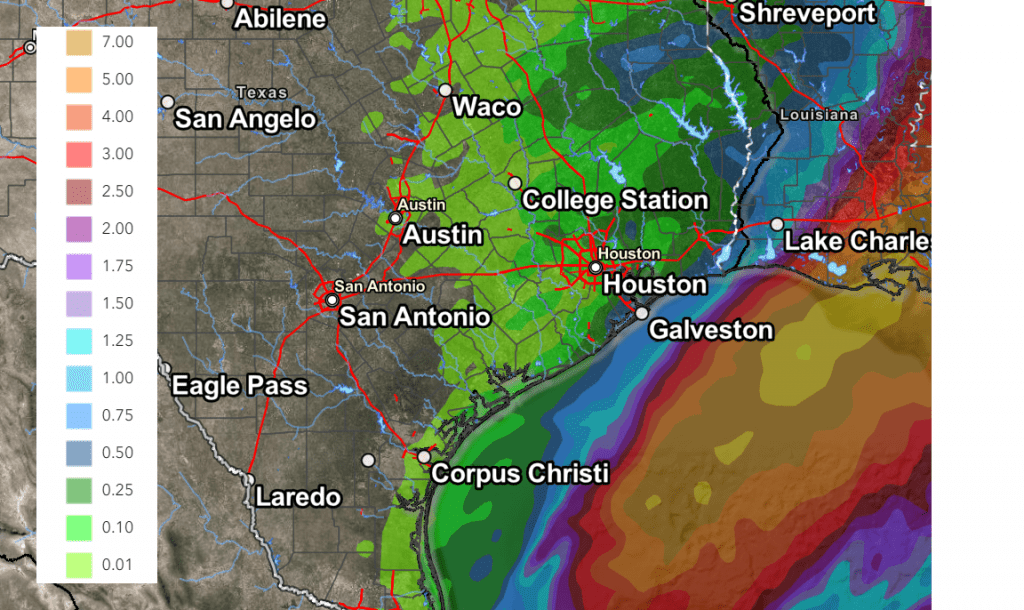
- Very little to no rain is forecast for the Austin area and the Hill Country. A few showers will be possible Wednesday for the area between Austin and Columbus
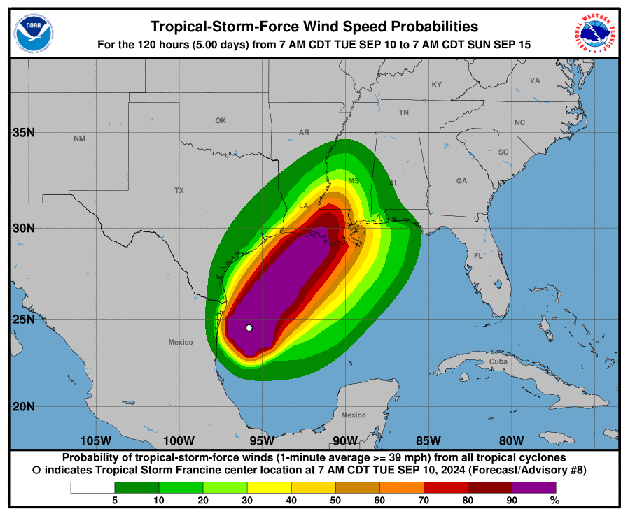
- Gusty winds and scattered showers are forecast for areas south of Interstate 10 Tuesday night through Wednesday afternoon. Rain amounts are predicted to stay below a quarter inch.
- Francine is forecast to make landfall along the central Gulf coast of Louisiana late Wednesday afternoon/Wednesday evening
Discussion
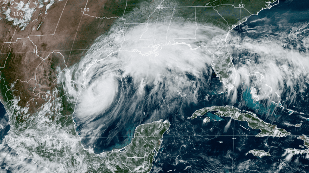
Although Francine appears to be getting better organized on satellite and Doppler radar, it has not yet translated into an increase in the wind speeds at the surface. The National Hurricane Center’s 10 am update indicated Francine was still a tropical storm, with maximum winds of 65 mph. The tropical storm was centered about 130 miles east-southeast of the Mouth of the Rio Grande River. Strengthening is forecast through Wednesday morning, and Francine will likely become a hurricane later today or tonight, and be a high-end category one hurricane at landfall.

NOAA/Colorado State University/RAMMB 09-10-24 2:30 pm CDT
Francine is moving toward the northeast near 9 mph. A turn to the northeast with an increase in forward speed is expected later today or tonight. On the forecast track, Francine is anticipated to be just offshore of the coasts of northeastern Mexico and southern Texas through Tuesday afternoon, then move across the northwestern Gulf of Mexico Wednesday. Francine is forecast to make landfall along the central Gulf coast of Louisiana sometime late Wednesday afternoon.

Based on the latest forecast track for Francine, the storm is expected to bring very few, if any weather impacts to the Hill Country and the Austin/Central Texas area. There will be a 20 percent chance for a few light showers and isolated thunderstorms over the area between Bastrop and Columbus late Tuesday night through Wednesday afternoon. Rain amounts, if any, should total less than a tenth of an inch. Expect northerly winds at 10-15 mph.
For Wharton and Matagorda Counties, there will be a 40-50 percent chance for showers and scattered thunderstorms beginning Tuesday night, continuing through Wednesday afternoon. Rain amounts through Wednesday are forecast to average less than a quarter inch across Wharton County and less than a half inch across Matagorda County. Expect northerly winds with speeds of 10-15 mph and gusts up to 30/35 mph.
A water rise of 1 to 3 feet above normally dry ground (4.0-5.0 ft above MLLW) is forecast for the middle and upper Texas coast. This will be somewhat similar in magnitude to the water level experienced with Tropical Storm Alberto in June, and 2 to 3 feet lower than what occurred with Hurricane Beryl. Minor coastal flooding can be expected on Wednesday at the times of high tide.
The strongest winds are predicted to remain offshore of the middle and upper Texas coast.

WPC Rainfall Forecast Valid through 7 am Friday:

Dry and warmer weather is forecast across the entire region late week and through the weekend as the summer heat dome makes a return appearance. There will be a slight chance for rain Sunday into Monday.
Bob


Social Media