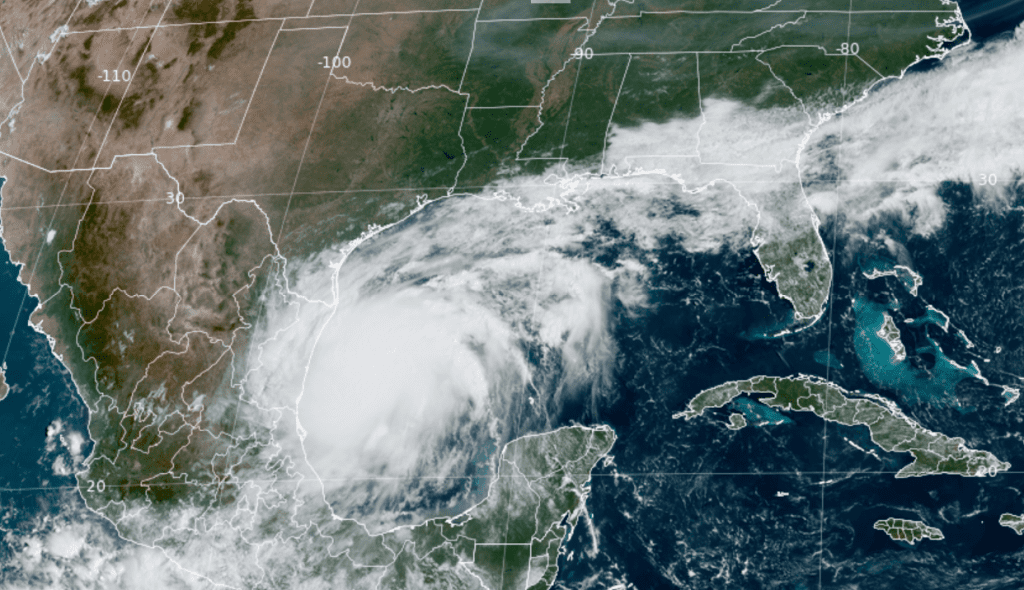
Morning satellite imagery shows the structure of the tropical disturbance over the southwestern Gulf of Mexico has improved significantly and now shows a large mass of clouds and thunderstorms surrounding the low pressure area. Data from an Air-Force Reconnaissance Aircraft is providing enough evidence to suggest a well-defined circulation now exists.

NOAA/Colorado State University 09-09-24 10:30 am CDT
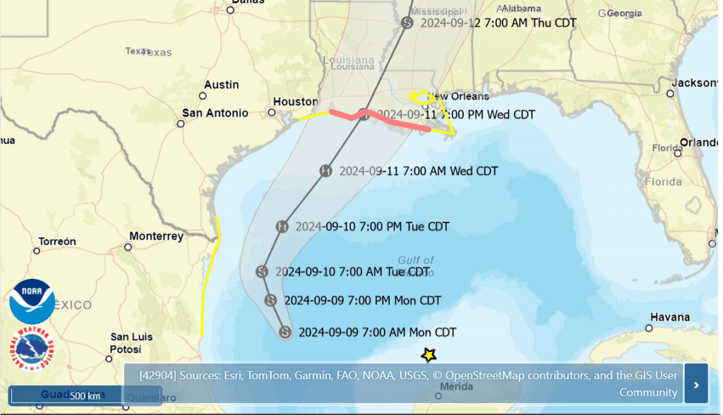
As of 10 am CDT, the center of Tropical Storm Francine was located over the southwestern Gulf of Mexico, roughly 245 miles southeast of the mouth of the Rio Grande River. Maximum sustained winds were near 50 mph, with higher gusts. Gradual intensification is expected through Tuesday, with more significant intensification expected Tuesday Night and Wednesday. Francine is forecast to strengthen into a category 1hurricane before it reaches the Louisiana coast Wednesday.
Francine is currently moving toward the north-northwest near 5 mph. A slow north-northwestward motion is expected for the remainder of today, followed by a faster motion and a turn to the northeast on Tuesday. The National Hurricane Center’s forecast track calls for Francine to continue moving to the northeast late Tuesday into Wednesday, with the storm making landfall somewhere along the southwestern or central Gulf coast of Louisiana Wednesday evening. The center of Francine is predicted to pass roughly 175 to 200 miles east of the middle Texas coast Tuesday night.
National Hurricane Center 10 am CDT Advisory 4 for Tropical Storm Francine:

Impacts
Based on the latest forecast track for Francine, few impacts can be expected across the Hill Country and the Austin/Interstate 35 corridor over the next couple of days. For areas east of Interstate 35, including Bastrop and Fayette Counties, there will be a 30-40 percent chance for a few scattered rain showers and isolated thunderstorms beginning after midnight Tuesday night, continuing through Wednesday afternoon. Rain amounts are forecast to average around a quarter inch or less. Northeast winds of 10-15 mph and gusts to 25 can be expected Wednesday.
The greatest impacts from Francine are expected for areas located to the south of Interstate 10. Clouds and scattered rain showers are forecast to spread over the area Tuesday, continuing Tuesday night through Wednesday. The most favorable period for rain is forecast to be on Wednesday, with a probability of rain near 80 percent. Northeasterly winds are forecast to increase to 10-15 mph, with gust to 30/35 mph Tuesday, continuing in that range Tuesday night through Wednesday afternoon. Rain amounts of 1-2 inches are forecast across Wharton and Matagorda Counties through Wednesday.
With increasing northeasterly winds expected along the upper Texas coast over the next couple of days, considerable sea water will be pushed toward the coast. This is expected to result in water level rises of 1-3 feet above normal dry ground near the middle and upper Texas coasts.
Rainfall Forecast
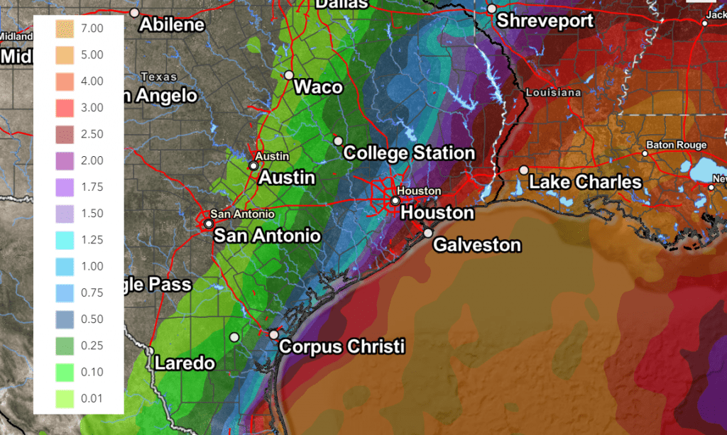
NOAA’s Weather Prediction Center’s rainfall forecast calls for the heaviest rains with Francine to remain over the Gulf waters and into much of Louisiana.
NWS Rainfall Forecast Valid through 7 am Thursday:

Bob


Social Media