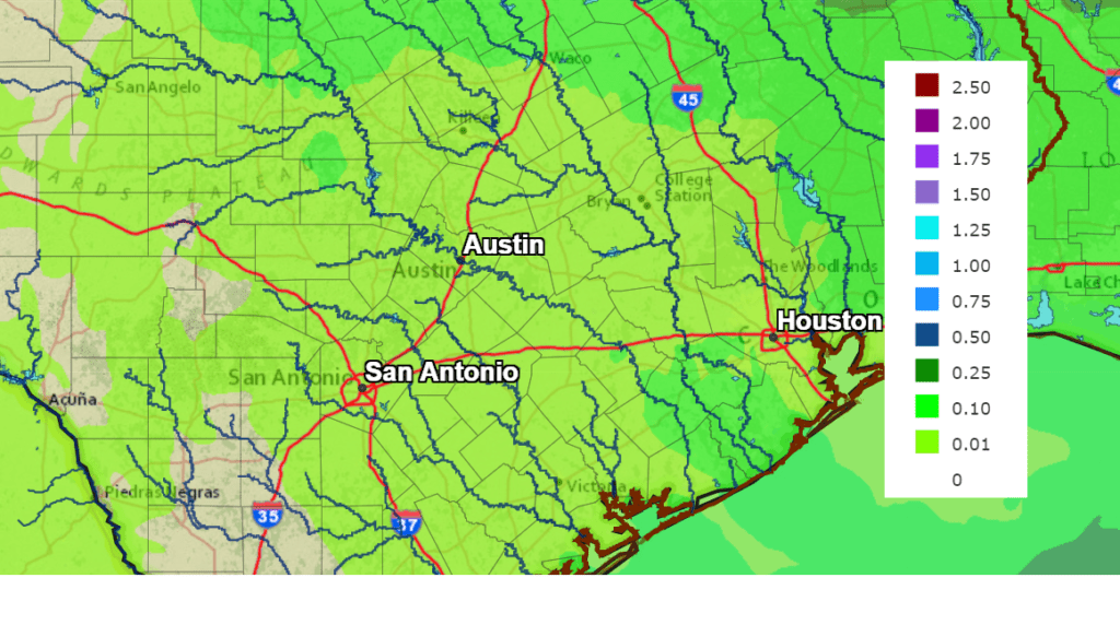
The chance for rain that looked so promising for Sunday earlier this week has unfortunately begun to decrease. Forecasts call for a cold front to push south across our region Sunday afternoon into Sunday evening. Recent forecast data indicates moisture levels ahead of the front will not be as generous as was predicted earlier. As a result, rain amounts now are forecast to total less than a quarter inch.
A second chance for rain is forecast to develop Tuesday when a trough of low pressure moves across the southern Plains states, causing a weak overrunning pattern to develop. There will be a 20-30 percent chance for rain Tuesday, with the chance for rain diminishing Tuesday evening. Rain amounts are forecast to total less than a tenth of an inch.
NWS Rainfall Forecast for the Period 6 pm Wednesday through 6 pm next Wednesday:
Sunny weather is predicted Wednesday and Turkey Day as a weak ridge of high pressure sets up over Texas. High temperatures will be in the mid-70s Wednesday, warming to around 80 degrees on Thursday.
Longer-range forecast solutions indicate yet another slight chance for rain will develop next Friday when a trough of low pressure and its associated cold front sweep southeast across the state. Rain amounts as of now are forecast to total less than a quarter inch. This front is expected to bring dry and slightly cooler weather conditions for next weekend. High temperatures should lower to the 60s, with lows in the 40s.
La Niña continues to reign supreme.
Bob
Social Media