Heat Ridge Weakens Late Week but Temperatures to Stay Close to the Century Mark
June 26, 2023
The early season heatwave will continue across the region this week, with widespread triple-digit temperatures expected through late week. The hottest readings of the week are forecast to occur today through Wednesday, as the center of the heat ridge slowly shifts from West to East Texas. Heat Advisories and Excessive Heat Warnings continue across the area.
Late week and into the upcoming weekend, the center of the heat ridge is forecast to set up near the Texas/Louisiana border and slowly weaken. As the ridge weakens, high temperatures are forecast to lower about 2-4 degrees at most locations, and hold close to 100 degrees. No rain is forecast this week as the high pressure ridge keeps the atmosphere too dry and stable.
Some changes in the weather pattern look to take place early next week as the ridge of high pressure over Texas and the south central U.S. is forecast to weaken further. With a weaker ridge in place, the atmosphere is expected to become a bit more unstable. Long-range forecasts call for a weak cold front to sag south and stall across North Texas early next week. The combination of the stalled front to our north and a less stable atmosphere will bring at least a slight chance for scattered showers and isolated thunderstorms to our region’s forecast beginning Monday, continuing late next week. The best chance for rain looks to occur during the second half of next week. Forecasts suggest parts of the area could see week-long totals of close to an inch.
High temperatures next week are forecast to hold mostly in the upper 90s.
Temperature Forecast for this Week
Hill Country
Monday through Wednesday: Expect highs near 102-106 degrees.
Thursday: A high near 102.
Friday and through the Weekend: Highs close to 100 degrees.
Central Texas
Monday through Wednesday: Expect highs near 101-105 degrees.
Thursday: A high near 102.
Friday and through the Weekend: Highs close to 100 degrees.
Coastal Plains
Monday through Next Sunday: Expect high temperatures to hold mostly in the upper 90s.
Tropical Weather Outlook
Tropical Storms Bret and Cindy both dissipated over the weekend and conditions across the tropical Atlantic have become fairly quiet. The remnants of Cindy could possibly redevelop late this week across the northwestern Atlantic, but pose no threat to the Gulf of Mexico.
National Hurricane Center forecasters are monitoring a surface trough of low pressure, associated with the remnants of Tropical Storm Cindy, located more than 500 miles to the south-southeast of Bermuda. The trough is producing an area of disorganized showers and thunderstorms. While strong upper-level winds are expected to prevent redevelopment of this system over the next day or two, environmental conditions could then become a little more favorable for some gradual redevelopment during the latter part of this week. This system should move generally northward into the northwestern Atlantic ocean, passing near Bermuda on Thursday. NHC forecasters are giving this system a 30 percent chance for tropical development over the next 7 days.
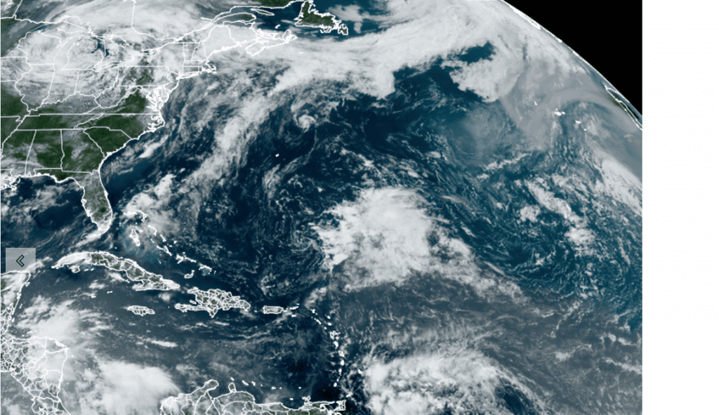
NOAA/Colorado State University/RAMMB 06/26/23 1:20 pm CDT
Have a good week and stay cool!
Bob
Social Media