The area of rain which moved across parts of the Hill Country and the Interstate 35 corridor Monday morning and early Monday afternoon is now exiting into Southeast Texas.
Forecasters are now keeping a close watch on the Interstate 35 corridor, roughly between Waco, Austin, and San Antonio, where isolated to scattered strong to severe thunderstorm development will be possible late this afternoon and evening. In the wake of this morning rain, some breaks in the clouds have developed allowing temperatures to climb to the mid-80s. Meanwhile in the upper atmosphere, winds have become structured in a way that will be favorable for some strong to severe thunderstorms to develop across the area. Severe weather threats will include large hail and damaging winds, but an isolated tornado or two cannot be ruled out.
This initial threat for strong severe storms is separate and in advance of a squall line that is predicted to sweep southeast across the region this evening and overnight. Afternoon high-resolution data calls for scattered to numerous showers and thunderstorms to develop across the Hill Country early this evening, with the rain activity forming into an established line of storms when it moves across the Interstate 35 corridor late this evening. The line of storms is forecast to reach the coastal plains region after midnight, then exit into the Gulf of Mexico by about 5 am.
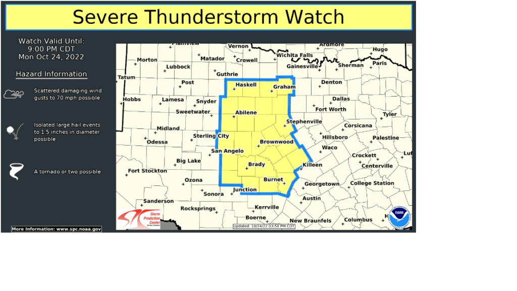
Strong, damaging straight line winds will be the greatest severe weather threat in association with the squall line. In addition, a couple of the storms could produce some large hail and an isolated tornado or two. The Storm Prediction Center continues to keep the eastern Hill Country and all of Central and Southeast Texas under a Slight Risk (a 2 out of 5 risk) for severe thunderstorms through early Tuesday morning. The Storm Prediction Center has issued a Severe Thunderstorm Watch until 9 pm Monday for the Big Country, extending south into the Hill Country.
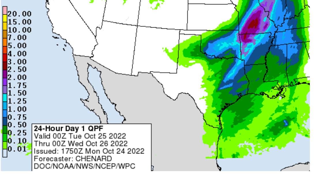
Forecast rain amounts overnight have not changed appreciably. Totals across the Hill Country are forecast to average less than a quarter inch. For all other locations, rain amounts are forecast to average between a quarter and a half inch, with a couple of isolated totals to near 1 inch.
NWS Rainfall Forecast for the Period 7 pm Monday through 7 pm Tuesday:
Concerns have increased for strong winds to develop in the wake of tonight’s cold front and squall line. High-resolution guidance is showing the potential for some very strong wind gusts to develop. As a result, the National Weather Service has posted a Wind Advisory for the eastern Hill Country and the Intestate 35 corridor, including the Austin metro area, from 11 pm Monday night, through 9 am Tuesday morning. Across the Hill Country and I-35 corridor, expect northwesterly winds to increase to a range for 20-25 mph, with gusts to 45-50 mph after midnight. Some even higher gusts are not will not be out of the question. East of the I-35 corridor, expect wind gusts to near 30-35 mph. Wind speeds are forecast to decrease to 10-20 mph, with gusts to 30 mph Tuesday afternoon and all the way down to around 5-10 mph Tuesday night.
With Halloween a week away, many folks have spooky objects and spider webs set up in their yard around their house. Make sure these objects will be secure from the strong winds!
Sunny weather is forecast Tuesday through Thursday. Expect high temperatures in the 70s Tuesday and Wednesday and into the low 80s Thursday. Another chance for rain is predicted for Thursday night and Friday.
Bob
Social Media