A Chance for Severe Storms and Heavy Rain Thursday
May 15, 2024
The weather pattern is forecast to become more unsettled late Wednesday night into Thursday morning as a vigorous trough of low pressure begins to push east out of southern Arizona. At the same time, a warm front will begin to lift north from the Gulf of Mexico, allowing for a quick return of warm and very moist air. As moisture levels increase, scattered showers and isolated thunderstorms are predicted to develop and spread across the region Thursday morning.
While scattered showers will be possible Thursday morning, the main focus will be on Thursday afternoon, when scattered to numerous thunderstorms are forecast to develop across the Hill Country as the dry line pushes east out of West Texas. Some of these storms will have the potential to become supercellular in structure, capable of producing very large hail and damaging wind gusts.
Forecasts call for the area of thunderstorms to gradually evolve into a large complex of showers and thunderstorms that will then spread east-southeast across the Hill Country and parts of Central Texas Thursday afternoon into Thursday evening. Due to Thursday’s unusually moist and unstable environment, some of the thunderstorms may be strong to severe. Large to very large hail, damaging winds, and isolated tornadoes will all be possible.
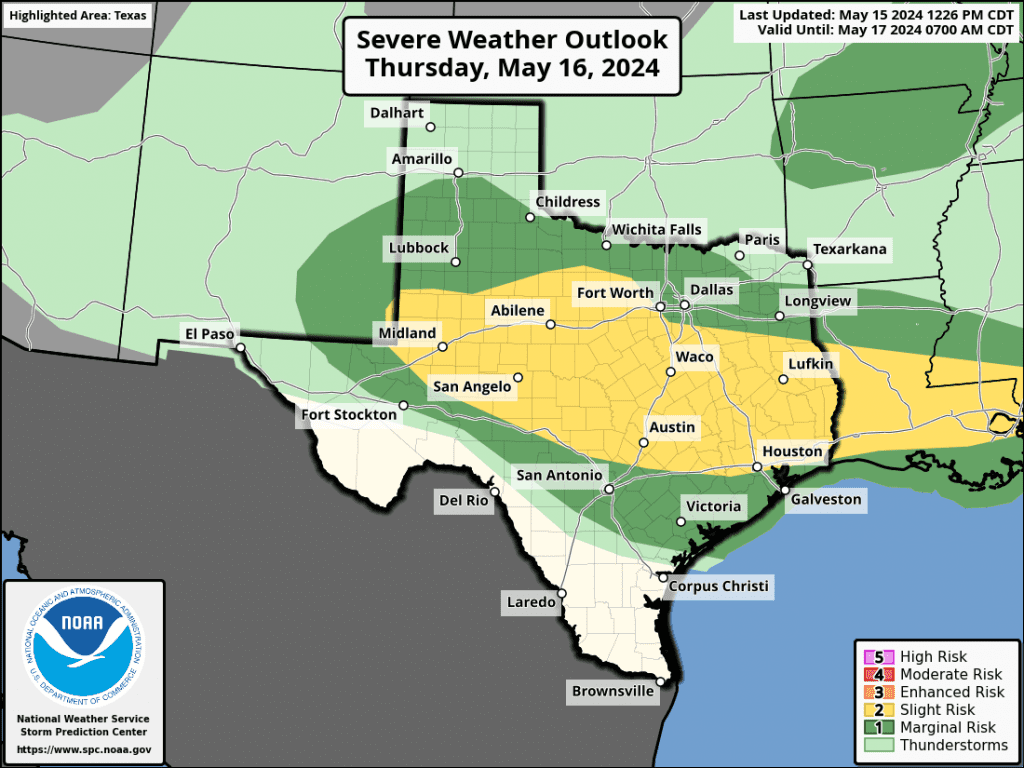
The Storm Prediction Center has placed most of the Hill Country and Central Texas under a Slight Risk, or 2 out of 5 risk, for severe thunderstorms on Thursday. A Marginal Risk for severe thunderstorms is forecast for the middle Texas coast.
The showers and storms are predicted to exit the Hill Country Thursday evening, and by midnight across Central Texas and the middle Texas coast.
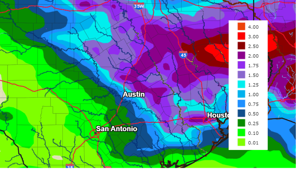
Additionally, there will be a potential for pockets of moderate to heavy rainfall from Thursday’s storms—primarily across the northern and eastern Hill Country, and also from the Austin area southeast to near La Grange and Columbus. Across this area, National Weather Service rainfall forecasts call for totals as high as 1-2 inches. Considerably lower totals are forecast for the western and central Hill Country.
NWS Rainfall Forecast for the Period 7 pm Wednesday through 7 pm Friday:
Following Thursday’s storms, a dry weather pattern will take shape across the region. In fact, a summer-like heat dome is forecast to build north out of Mexico this weekend into next week, which is expected to cause sunny, dry, and unusually warm conditions. High temperatures next Monday through Friday are predicted to generally be in the mid-90s.
Bob
Social Media