Today’s sunny weather will transition to a cloudy pattern tonight through Wednesday as southerly breezes pull moisture back north from the Gulf of Mexico. Forecasts call for the atmosphere to become quite moist by Wednesday evening and this will likely lead to the development of persistent, light rain showers and fog across much of the area Wednesday night. Near steady temperatures in the upper 50s are predicted.
Our weather is forecast to become fairly active Thursday as a trough of low pressure over southern New Mexico tracks east-northeast into Northwest Texas and the South Plains. The approaching trough will help pull a warm front north through the area Thursday morning, causing more light showers and drizzle. Gulf air spreading north behind the warm front is expected to cause the atmosphere to become moderately unstable across the coastal plains and much of Central Texas by about mid-morning. As of now, this unstable air mass is not expected to reach into the Hill Country.
Showers and scattered thunderstorms are predicted to develop across the Hill Country and Central Texas regions by about mid-morning as the atmosphere become increasingly unstable. Stronger forcing looks to arrive late morning and through the afternoon and expected to cause an increase in widespread shower and thunderstorm development. Forecasts indicate some of the storms may become strong to severe. Strong low to mid level shear will support the development of scattered low-topped supercell thunderstorms –somewhat similar to those experienced on October 26th. These storms will be capable of producing a few tornadoes, large hail, and damaging winds.
The threat for severe storms is forecast to diminish across Central Texas by about 4 or 5 pm. Across the middle Texas coast, the severe threat is predicted to continue until about 8 or 9 pm. The chance for rain is forecast diminish Thursday evening as drier air spreads in from the west.
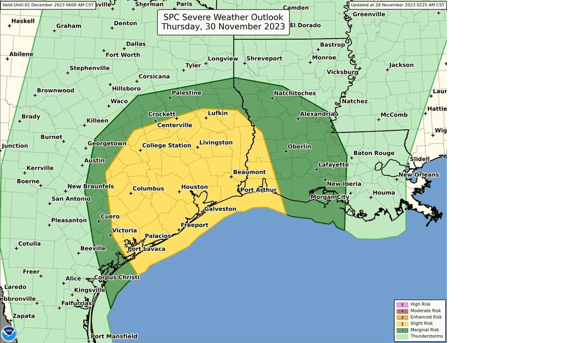
The Storm Prediction Center is showing a Slight Risk (a 2 out of 5 risk) for severe thunderstorms over Fayette, Lee, Colorado, Wharton, and Matagorda Counties Thursday. A Marginal Risk (a 1 out of 5 risk) for severe storms is indicated for Bastrop, Milam, and Gonzales Counties. Scattered, general thunderstorms are forecast for Travis, Hays, and Williamson Counties, and areas to the west. The severe weather threat could potentially shift west into the Interstate 35 corridor, so stay tuned for updates between now and Thursday.
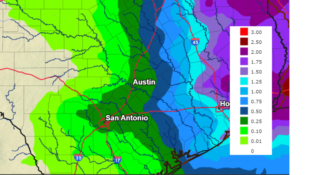
Rain amounts between Wednesday evening and Thursday evening are expected to be highest across the coastal plains and lowest across the Hill Country. Totals of 1-1.5 inches are predicted for the coastal counties.
NWS Rainfall Forecast for the Period 6 pm Tuesday through 6 pm Friday:
Mostly sunny and dry weather is forecast for Friday and the weekend.
Bob
Social Media