Managing Floods in Flash Flood Alley
Flood Operations Report
Lake level projections and flood operations
Hydromet & weather conditions
Data from 275 automated weather and river gauges
Flood Operations Notification Service
Flood operations alerts along the Highland Lakes and Lake Bastrop
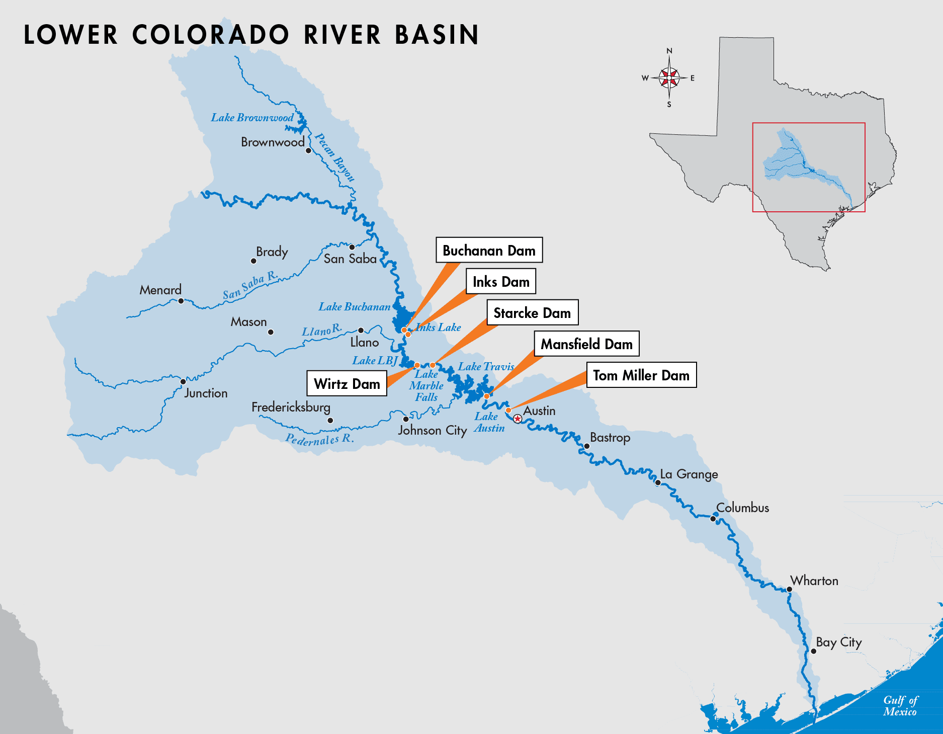
As the Colorado River flows toward the Gulf of Mexico, it receives rainfall and storm runoff from the Hill Country upstream of Austin, and counties downstream of Mansfield Dam, including Travis, Hays, Bastrop, Fayette, Colorado, Wharton and Matagorda.
Managing floodwaters
During a flood, LCRA manages the Highland Lakes on the Colorado River to reduce the severity of river flooding in Austin and other locations downstream of the lakes.

Lake Buchanan
Unlike Lake Travis, Lake Buchanan has no room to store floodwaters after it is full. Under an agreement with FEMA, LCRA manages Lake Buchanan to a maximum level of 1,018 feet above mean sea level (feet msl) from May through October, and to a maximum level of 1,020 feet msl the rest of the year. LCRA is working to change the maximum operating level of the lake to 1,020 feet msl year-round.
Lake Travis
Lake Travis, formed by Mansfield Dam, is the only one of the six Highland Lakes designed to capture and store floodwaters. Lake Travis is considered full for water supply purposes at 681 feet msl. However, the lake has the capacity to hold an additional 33 feet or 776,062 acre-feet of water in its flood pool. Any area in the flood pool is subject to being inundated. FEMA and local officials – not LCRA – designate floodplains and control development of property in floodplain areas.
LCRA conducts flood operations at Mansfield Dam in accordance with the U.S. Army Corps of Engineers Water Control Manual for Mansfield Dam and Lake Travis. Read more about flood operations at Mansfield Dam.
Lake Travis’ flood storage capability helps protect Austin and downstream communities, but it cannot prevent flooding along creeks and streams that are tributaries to the Colorado River, or from rain that falls downstream of Mansfield Dam.
Pass-through lakes
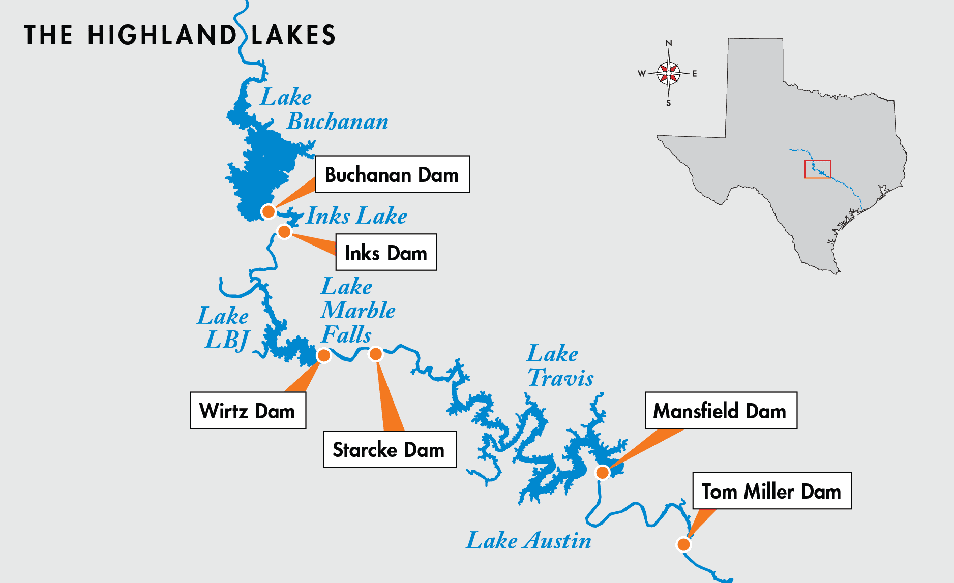
The smaller, pass-through lakes — Inks, LBJ, Marble Falls and Austin — have no capacity to store floodwaters. While they typically are operated within a range of about a foot, the lakes are not “constant level” and can rise well above their normal operating ranges during floods. Lake levels can vary even along the length of each lake.
Estimated flow times for floodwaters*

Water can move quickly though the Highland Lakes because the elevation drops about 600 feet over 116 river miles – from upstream of Buchanan Dam to downstream of Tom Miller Dam. Releases from Mansfield Dam take longer to flow downstream because the terrain is less steep along the 318-mile journey to the Gulf of Mexico. The Colorado River is more than three times as steep through the Highland Lakes as it is from Austin to the Gulf Coast.

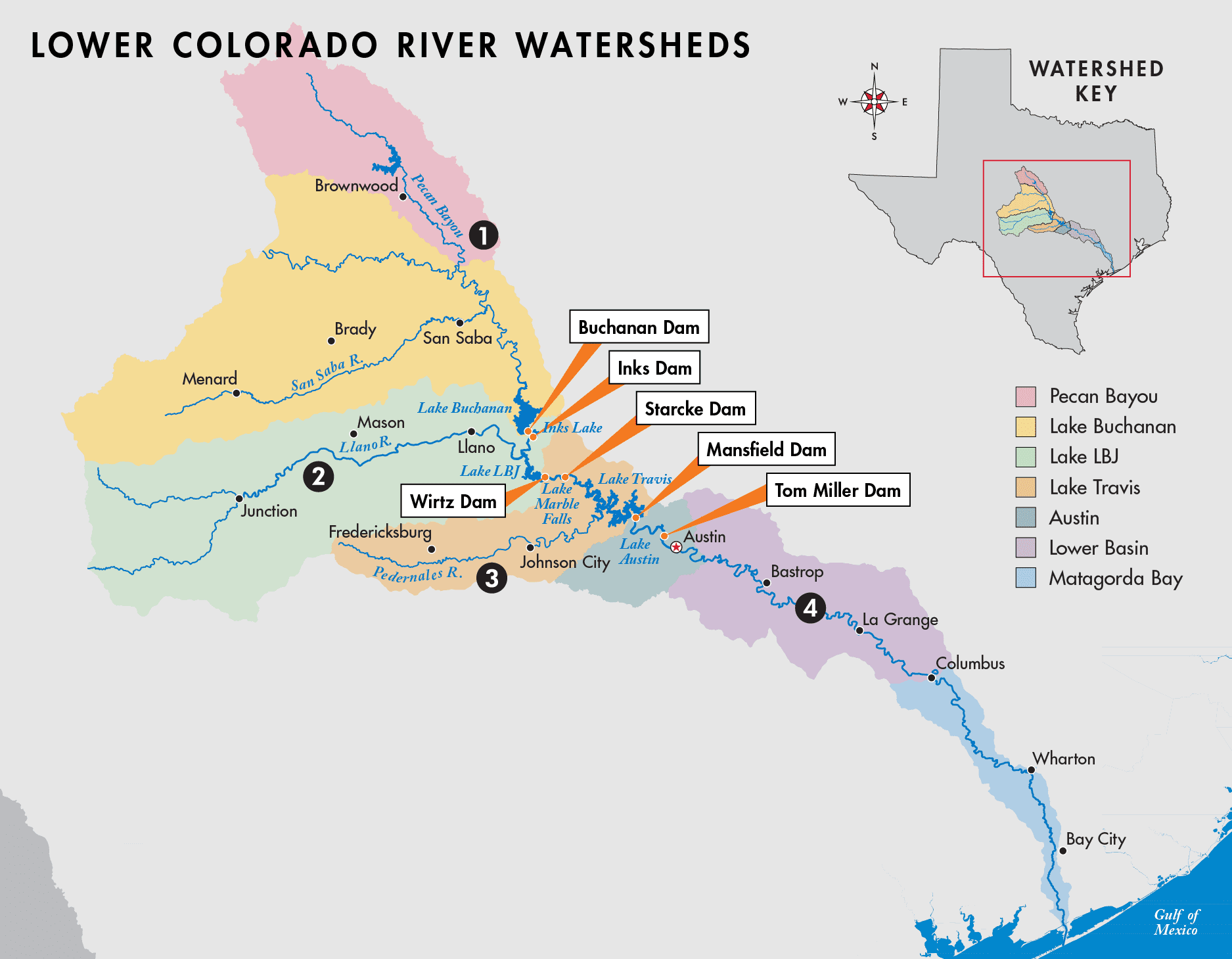
- Extreme weather in Pecan Bayou and Lake Buchanan watersheds can affect Lake Buchanan. Heavy rains in Brown, Coleman, San Saba, Mills and portions of Lampasas, Burnet and Llano counties will reach Lake Buchanan in a relatively short time. Lake Buchanan is filled primarily from this runoff
- Rainfall in Kimble, Mason, Llano and portions of other surrounding counties in the LBJ watershed can send floodwaters into Lake LBJ. Floodwaters from Lake Buchanan also flow through Lake LBJ. This water is passed downstream into Lake Travis.
- The Pedernales River, which flows into Lake Travis, collects runoff primarily from Gillespie and Blanco counties in the Lake Travis watershed. This river can send a large amount of water into Lake Travis in a short amount of time.
- Runoff from rainfall below Mansfield Dam in the Austin, Lower Basin and Matagorda Bay watersheds can cause severe flooding downstream, even when no floodwaters are released from Lake Travis.
RESOURCES
How to monitor flooding
Flood Operations Report
LCRA Hydromet
Flood Operations Notification Service (FONS)
LCRA on Twitter and Facebook
Other flood resources
FEMA Flood Map Service Center
Texas Department of Insurance “Who should have flood insurance?”


Social Media