The Threat for Wintery Weather Across Central Texas has Decreased
JAN. 7, 2025
Here’s an update on this week’s cold weather pattern and the potential for wintery precipitation. There have been some important changes in the outlook.
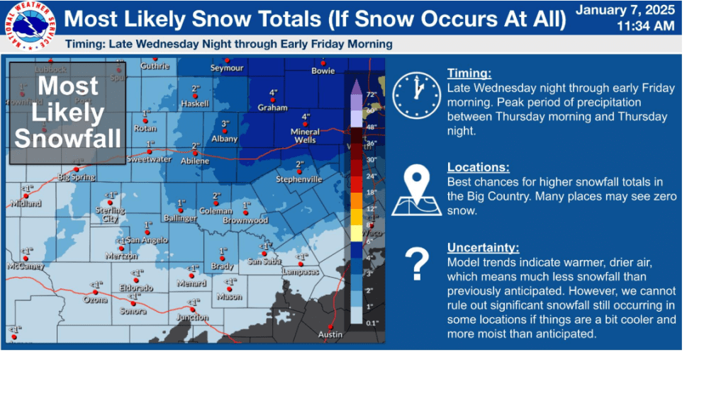
Tuesday’s forecast solutions are indicating the trough of low pressure that is forecast to move across Texas out Mexico Thursday into Friday will track slower and arrive a bit later than was previously forecast. With the low staying out west longer, it should allow more time for slightly warmer air spread north into Texas before the onset of precipitation. With slightly warmer air in place , the threat area for wintery precipitation has decreased significantly across the Austin/Central Texas area. However, a threat for a mix of wintery precipitation will continue across the Hill Country and Edwards Plateau regions late Wednesday night through Thursday night.
Looking at temperatures through Friday:
- Lows Wednesday morning will range from the low and mid-20s across the Hill Country to around 28-30 degrees across Central Texas, to the low and mid-30s across the coastal plains
- High temperatures Wednesday are forecast to be in the low and mid-40s
- Low temperatures Thursday morning are forecast to be in the upper 20s across the Hill Country, in the low 30s across Central Texas, and in the upper 30s across the coastal plains
- Temperatures Thursday are forecast to hold fairly steady in the upper 30s across the Hill Country and Central Texas regions, but warm close to 50 degrees across the coastal plains
- Lows Friday morning will range from the low and mid-30s across the Hill Country, to the upper 30s across the coastal plains
- High temperatures Friday are forecast to be in the low and mid-40s
The sky is forecast to be partly cloudy Tuesday night and become mostly cloudy Wednesday through Wednesday evening. The threat for precipitation is not expected to begin until around midnight Wednesday night.
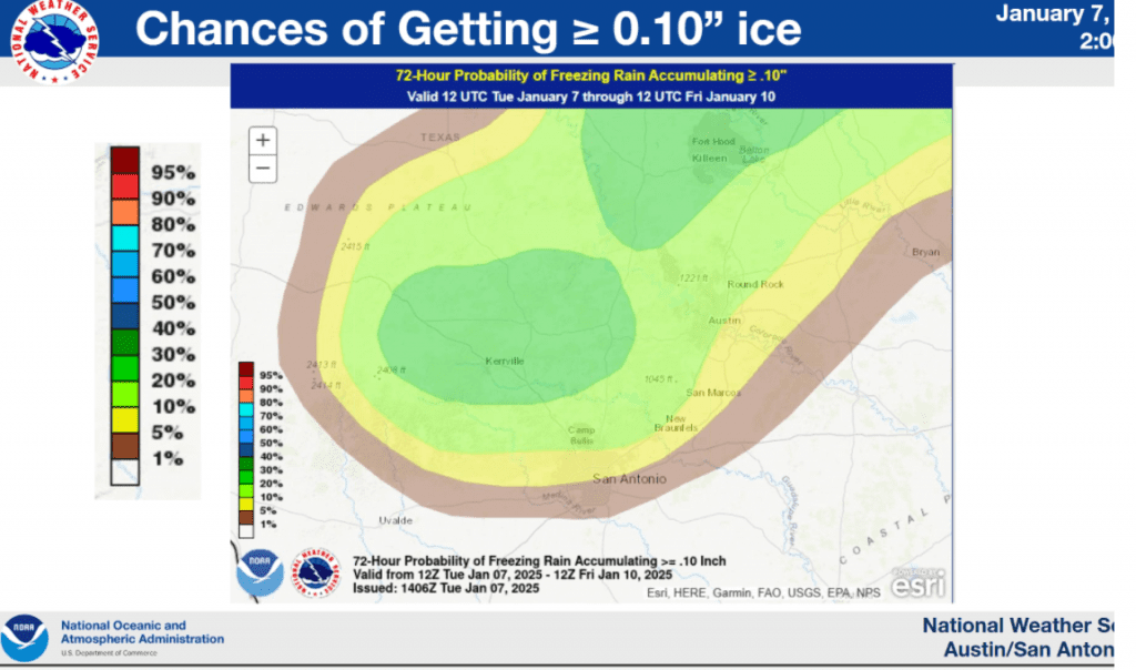
For the Hill Country (areas west of Interstate 35) and Edward Plateau regions, light overrunning precipitation is forecast to begin around midnight Wednesday night and continue into Thursday morning. A mixture of light rain, light freezing rain, and light snow showers is forecast. On Thursday, there will be periods of rain showers with some freezing rain in some of the colder pockets—especially in the morning. However, with the temperature predicted to go above freezing by midday, expect mostly rain. Ice accumulations to around a tenth of an inch will be possible Thursday morning. (See the probability for ice map below) Periods of rain look to continue Thursday evening and Thursday night. Some light snow showers will be possible. All of the precipitation is forecast to diminish by around sunrise Friday.
For the Austin and Central Texas region, scattered light rain showers will develop and spread over the area after midnight and continue into Thursday morning. Some of the coldest locations to the west and northwest of Austin could see some freezing rain Thursday morning, but most locations will likely see just a cold rain throughout the day, continuing into Thursday evening and Thursday night. The chance for rain should diminish around mid-morning Friday.
For the middle Texas coast, widespread rain showers look to develop Thursday morning and continue Thursday afternoon and Thursday night. The chance for rain should diminish by midday Friday.


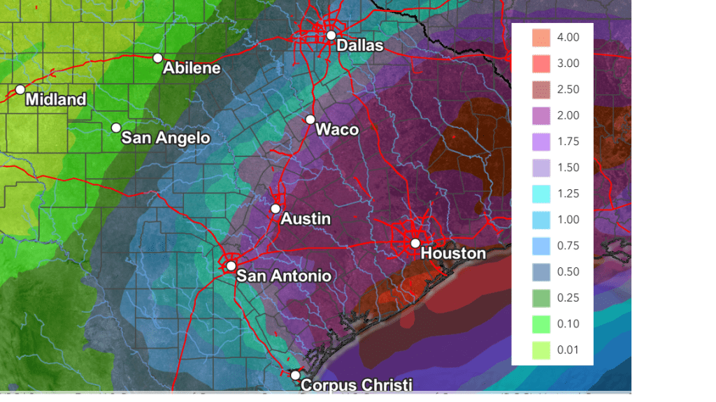
Forecasted rainfall amounts for Thursday have increased. Totals of 0.5 to 1.5 inches are now forecast across most of the Hill Country, and totals of 1-2 inches are forecast for areas along and east of Interstate 35.
NWS Rainfall Forecast for the Period 6 pm Tuesday through 6 pm Friday:

Bob


Social Media