Tropical Storm Bret Forms in the Central Tropical Atlantic
June 19, 2023
The strong tropical wave which moved off the coast of Africa late last week has strengthen and become a tropical storm and given the name Bret. As of 4 pm CDT Monday, Bret was located over the central tropical Atlantic, about 1295 miles east of the southern Windward Islands. Bret was moving toward the west near 21 mph, and this motion is expected to continue for the next several days. Maximum sustained winds have increased to near 40 mph with higher gusts.
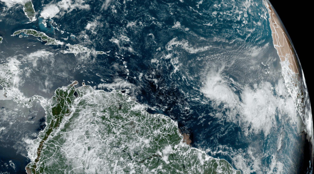
NOAA/Colorado State University/RAMMB 06/19/23 1:00 pm CDT
Bret is currently located in an environment that is conducive for further strengthening, and NHC forecasters call for Bret to become a hurricane in a couple of days. However, some slow weakening is expected Friday and through the weekend as Bret is forecast to run into an area with increased vertical wind shear.
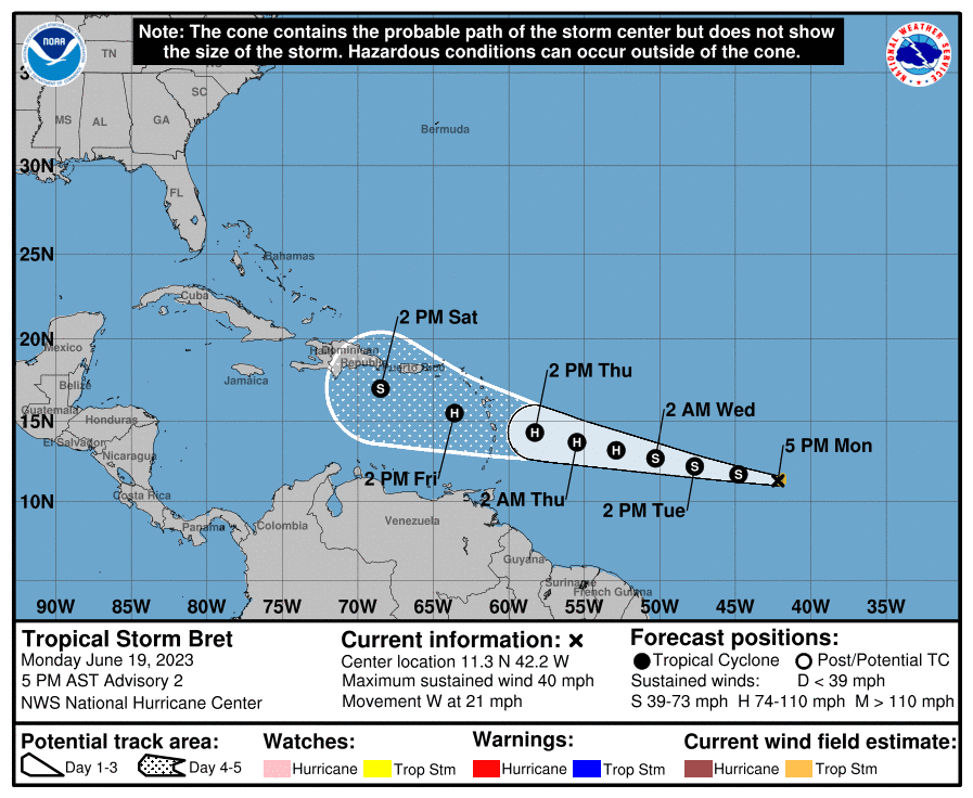
Bret is being steered to the west by a large ridge of high pressure situated over the central Atlantic Ocean. This general motion is forecast to persist for the next several days. But as Bret nears the Lesser Antilles late this week, the ridge is forecast to weaken, and this should cause the storm to move more toward the west-northwest.
The track beyond late this week is quite uncertain. Part of the uncertainty has to do with just how strong Bret becomes over the next few days. Some of the models that keep Bret the strongest show the storm turning more to the right, to the north of Puerto Rice and Hispaniola. Meanwhile, the European and UKMET Met global models call for significant weakening at long range, but show a track further west into the western Caribbean. The National Hurricane Center forecast track calls for a path between the two extremes, with an acknowledgement it is a low confidence forecast.
We will need to keep an eye on Bret over the next few days as the models get a better handle on its eventual track. A path into the Gulf of Mexico certainly cannot be ruled out at this time.
Forecasters are also monitoring a strong tropical wave located several hundred miles south-southwest of the Cabo Verde Islands. This system continues to produce a large area of disorganized showers and thunderstorms. Environmental conditions appear favorable for further development of this system, and a tropical depression could form in a couple of days while the system moves westward at 10 to 15 mph across the eastern and central tropical Atlantic. Forecasts call for this system to take a path to the northwest over the next few days, staying north of the Caribbean Sea. However, we will need to closely monitor the system and its eventual path.
No break from the triple-digit temperatures is expected this week. In fact, the current streak of tropical digit temperatures could stretch through late next week. More on that in Tuesday’s report.
Bob
Social Media