Excessive Heat Expected to Continue through Next Week. Little to No Rain Forecast
June 16, 2023
Key Message:
- Dangerous heat is likely to be in place for at least the next week
- Excessive Heat Warnings are in effect for Central and Southeast Texas from today through 8 pm Sunday. The warning will likely be extended further into next week
- It is strongly encouraged to practice heat safety through the holiday weekend, especially if you have outdoor activities planned
Our region is in the grips of an early-season heat wave that is showing few signs of backing down anytime soon. To make matters worse, an unusually moist maritime air mass covers South and Central Texas. The combination of the very air hot temperatures and the high humidity levels is leading to very uncomfortable conditions that are significantly increasing the potential for heat-related illnesses, particularly for those working or participating in outdoor activities.
The National Weather Service has upgraded the Heat Advisory for Central Texas and the middle Texas coast to an Excessive Heat Warning, and it will be in effect through 8 pm Sunday. Under the Excessive Heat Warning, Heat Index values up to 115 degrees will be possible.
A Heat Advisory is in effect for the Hill Country through 8 pm Sunday, where peak heat index values of 108-110 degrees are forecast.
The primary factor responsible for the current heat wave is an unusually strong ridge of high pressure in the middle and upper atmosphere that is ridging into Texas out of central Mexico. Forecasts call for the ridge to strengthen this weekend and the first half of next week. This will result in even hotter temperatures and little to no rain. Forecasts for late next week and next weekend call for the ridge to shift a bit more to the west and northwest. While this won’t make a huge difference in our weather, it is expected to cause about a 2-4 degree drop in high temperatures. Unfortunately, the heat wave is forecast to continue into the last week of June.
Long-range forecasts call for little to no rain over the next week. Some isolated rain showers may return to the forecast beginning next weekend.
Here’s a breakdown of the forecast and outlook
Friday through Friday Night
Mostly sunny and hot weather will be in place across the region. However, there will be a very slight chance for a few isolated late afternoon and evening thunderstorms over parts of the Hill Country and Central Texas, generally north of a line stretching from Bandera, to Austin, to Hearne. A weak cold front sagging south out of North Texas could trigger the development of a few isolated late day thunderstorms. The probability for rain will be less than 20 percent. However, any developing storms may produce large hail and damaging winds. Any storms which do happen to develop should dissipate by late evening.
High temperatures Friday are forecast to be near 102-105 degrees across the Hill Country, near 100-104 degrees across Central Texas, and in the upper 90s across the coastal plains.
Saturday through Saturday Night
Mostly sunny and hot weather will continue. But similar to Friday, there will be a very slight chance for a few isolated late afternoon and evening thunderstorms over parts of the Hill Country and Central Texas, generally north of a line stretching from Bandera, to Austin, to Hearne. A stalled out cold front over the area and a weak passing disturbance could trigger the development of a few isolated late day thunderstorms. The probability for rain will be less than 20 percent. However, any developing storms may produce large hail and damaging winds. Any storms which do happen to develop should dissipate by late Saturday evening.
High temperatures Saturday are forecast to be near 100-105 degrees across the Hill Country and Central Texas regions, and close to 100 degrees across the coastal plains.
Sunday through Wednesday
Mostly sunny and vey hot weather will continue. Conditions appear unfavorable for any additional late day thunderstorms.
High temperatures are forecast to be near 102-105 degrees across the Hill Country and Central Texas regions, and near 100-103 degrees across the coastal plains.
Next Thursday through Next Weekend
Continued mostly sunny and hot!
High temperatures are forecast to be 100-102 degrees across the Hill Country and Central Texas regions, and near 98-100 degrees across the coastal plains.
Tropical Weather Outlook
A tropical wave moved off the west coast of Africa on Thursday and was located Friday between the west coast of Africa and the Cabo Verde Islands. The wave is currently producing disorganized showers and thunderstorms. However, environmental conditions appear to be conducive for gradual development, and a tropical depression could form during the early to middle portions of next week as the system moves westward at 15 to 20 mph across the eastern and central tropical Atlantic Ocean.
NHC forecasters are giving this system a medium chance, a 60 percent chance, for tropical development over the next seven days.
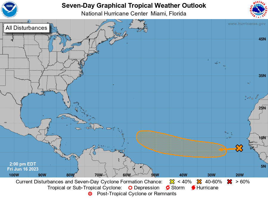
It is very early, but chances for this system to survive a trip into the Gulf of Mexico appear to be quite low at this time.
Elsewhere, conditions are quiet and tropical cyclone development is not expected.
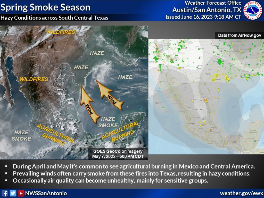
Recent Hazy Conditions Across Central and South Texas
According to the Texas Commission on Environmental Quality, the recent stretch of hazy conditions across the area is being caused by smoke from fires in Mexico and Central America being transported into Texas by strong south and southeasterly breezes. In addition, some aerosols from industrial activities across Mexico and Central America are also spreading into the state. According to the TCEQ, the hazy conditions should continue through the weekend, following by a slight reduction in the concentration of haze during the early and middle parts of next week.
Have a great weekend!
Bob
Social Media