…Forecasts are pointing toward another threat for strong to severe thunderstorms across the region beginning mid to late afternoon today, continuing overnight…
This afternoon’s weather is expected to be partly cloudy, warm, and humid in the wake of a warm front that has moved up to the north. All eyes are currently focused on a trough of low pressure in upper atmosphere that will be moving east across the southern Plains states this afternoon and tonight. The approaching trough is predicted to cause the atmosphere over North and Central Texas to become increasingly unstable this afternoon through tonight. Although a weak cap, or stable layer in the middle atmosphere is in place again today, atmospheric lift from the approaching trough may be strong enough to allow some isolated thunderstorms to develop and break through the cap in the mid to late afternoon and evening ours. Today’s atmosphere will be structured in such a way to allow any developing thunderstorms to quickly become severe. The primary severe weather threat will likely be large hail, followed by damaging downburst winds and isolated tornadoes. The eastern Hill Country and the Austin/Central Texas region will have the highest probability for seeing the isolated severe thunderstorms.
This evening and through the overnight hours, attention will turn a cold front that will be moving southeast out of Northwest Texas. Forecasts call for a large area of showers and strong to severe thunderstorms to develop along and behind the cold front as the front moves across the area. The front is predicted to reach the northern and western Hill Country early to mid-evening and the Austin/Interstate 35 corridor late evening and toward midnight. The line of rain and storms is expected to continue moving southeast across the eastern counties of Central Texas and the coastal plains region between midnight and sunrise Thursday. Storms along this line may be strong to severe, producing large hail, damaging winds and even a couple of isolated tornadoes.
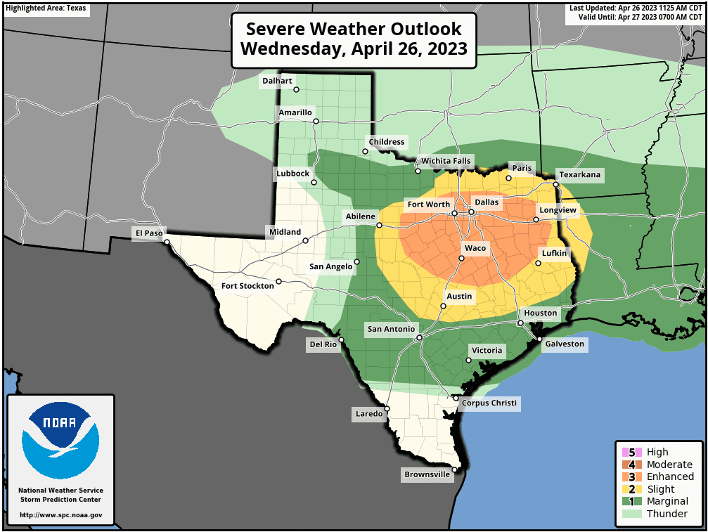
The Storm Prediction Center is showing the greatest threat for severe storms this afternoon and tonight to be over North Texas. However, SPC’s midday update expanded the Slight Risk area for severe storms to the south and west, and now includes the Austin metro area. The Slight Risk area extends as far west and south as Mason, Blanco, San Marcos, and La Grange. Surrounding the Slight Risk area, a Marginal Risk for severe thunderstorms is indicated for the rest of the region.
Some light rain showers may linger after sunrise Thursday, but all of the rain should end from west to east mid to late morning Thursday. A sunny sky will develop Thursday afternoon.
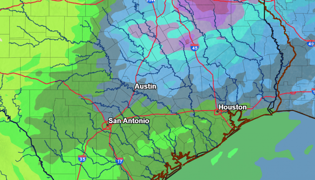
Rain amounts between this afternoon and midday Thursday call for widespread totals of 0.25-0.5 inches. Totals of 0.5 to 1 inch are forecast across the eastern Hill Country and the northern half of Central Texas, including Austin.
NWS Rainfall Forecast for the Period 7 am Wednesday through 7 am Friday:
Bob
Social Media