Updated forecast solutions are pointing toward an increased potential for periods of showers and thunderstorms beginning Thursday afternoon, continuing through Friday afternoon. Forecasts call for the atmosphere over the eastern two-thirds of Texas to become fairly moist and unstable Thursday ahead of a trough of low pressure dipping south out of the southern Rockies. As temperatures warm into the low and mid-80s Thursday afternoon, rain showers and scattered thunderstorms are forecast to develop. Additional showers and thunderstorms are forecast Thursday night through Friday as a cold front slowly sinks to the south out of North Texas. We may see a more concentrated area of thunderstorms develop along the cold front Friday morning into Friday afternoon.
Some of the thunderstorms Thursday through Friday may be strong and severe. The Storm Prediction Center has placed the eastern Hill Country and most of Central Texas, including the Austin area, under a Slight Risk, or 2 out of 5 risk, for severe thunderstorms Thursday trough 7 am Friday. The Slight risk area shifts to locations southeast of Austin on Friday. A Marginal Risk, or 1 out of 5 risk, for severe thunderstorms surrounds the slight risk area both days.
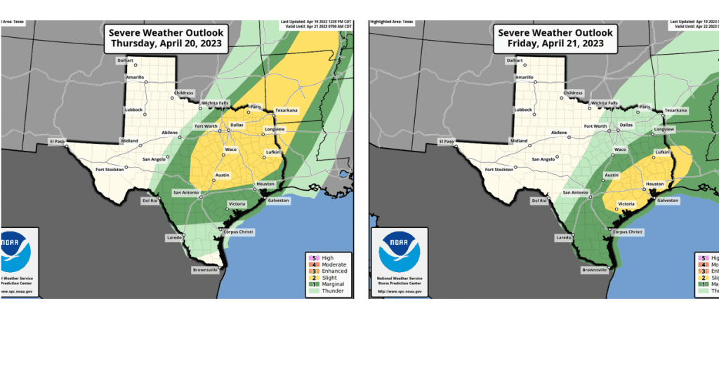
The primary severe weather threat will be large hail, with a lower probability for damaging winds and isolated tornadoes.
The probability for rain through the period is predicted to be near 50-60 percent. The chance for rain will end from north to south Friday afternoon as cooler and drier air spreads in behind the cold front.
Forecast rain amounts over the next two days have increased across Central Texas and the middle Texas coast. Totals through Friday night call for totals of 0.25 -0.5 inches across the eastern Hill Country, and between 0.5 and 1.5 inches across Central Texas and the middle Texas coast.
NWS Rainfall Forecast for the Period 7 pm Wednesday through 7 pm Saturday: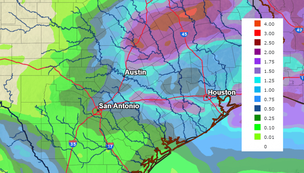
Sunny and dry weather is forecast Saturday. However, another chance for rain and thunderstorms is forecast to develop late Sunday into next Monday. This system has the potential to bring another 0.25 to 0.5 inches of rain to much of our area.
Bob
Social Media