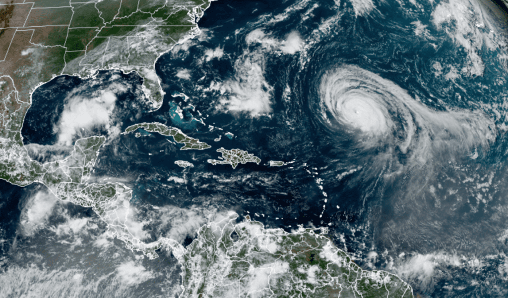
The area of disturbed weather which has lingered over the Bay of Campeche the past few days has moved into the south-central Gulf of Mexico. According to the National Hurricane Center, showers and thunderstorms increased Tuesday in association with a surface trough and an upper-level disturbance. The system is predicted to move slowly northeastward over the central and northeastern Gulf of Mexico during the next couple of days. Although upper-level winds are currently unfavorable for development, they are expected to become more conducive for some limited tropical or subtropical cyclone development as the system nears the northern Gulf coast on Wednesday and Wednesday night. The disturbance is then expected to cross the southeastern United States, and some slight additional development will be possible after it emerges off the southeastern United States coast late this week. Regardless of development, areas of heavy rainfall will be possible across portions of the Florida panhandle and southern Georgia on Wednesday and Thursday, with localized flooding possible. NHC forecasters are giving this system a medium chance (a 40 percent chance) for tropical development over the next 5 days.

NOAA/Colorado State University 09/07/2021 1:40 pm CDT
Over in the central tropical Atlantic, large Hurricane Larry remains a major hurricane. As of 4 pm CDT, the center of Hurricane Larry was located About 715 miles southeast of Bermuda. Larry was moving toward the northwest near 9 mph, and this general motion is expected to continue through Wednesday. A turn toward the north-northwest and north with an increase in forward speed is forecast on Thursday. On the forecast track, the center of Larry should pass east of Bermuda on Thursday. Maximum sustained winds remain near 115 mph with higher gusts. Larry is a category 3 hurricane on the Saffir-Simpson Hurricane Wind Scale. Slow weakening is forecast during the next several days.
Larry is a large hurricane. Hurricane-force winds extend outward up to 70 miles from the center and tropical-storm-force winds extend outward up to 185 miles.
Elsewhere in the tropical Atlantic, there are currently no features posing a threat for tropical development over the next few days.
Bob


Social Media