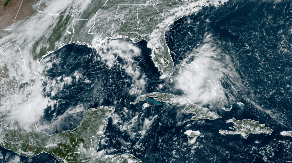
National Hurricane Center forecasters are closely monitoring a large area of shower and thunderstorm activity located over the northwestern and central Bahamas and the adjacent waters. Surface observations on Friday indicated pressures were falling over the northwestern and central Bahamas, a sign the broad area of disturbed weather was beginning to organize and an area of low pressure system could be forming between the northwestern Bahamas and South Florida.

NOAA-RAMMB 09-11-20 1:30 pm CDT
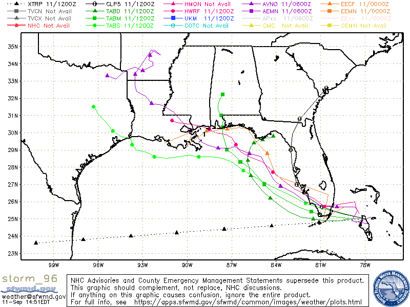
This system is forecast to move westward at about 10 mph, and it could become a tropical depression while it is near South Florida Friday night. But if not, the disturbance is expected to become a tropical depression while it moves slowly west-northwestward over the northeastern Gulf of Mexico this weekend and early next week. Regardless of development, this system is expected to produce locally heavy rainfall over portions of the Bahamas, South Florida,and the Florida Keys during the next couple of days, and interests there, as well as along the northern and eastern Gulf coast, should monitor its progress.
Conditions in the eastern Gulf of Mexico appear to be conducive for the formation of a tropical system and the National Hurricane Center has increased the potential for tropical development with this system to 80 percent over the next 5 days. Most of the forecast solutions call for the system to take a west-northwesterly path in the direction of the north-central Gulf coast between Louisiana and the Florida Panhandle early next week as they system gets pulled toward a weak trough of low pressure over the Middle Mississippi Valley early next week. However we will need to keep a close eye on this system should it take a path further to the west.

The National Hurricane Center is monitoring several other systems in the tropical Atlantic. Tropical Storm Paulette is located about 795 miles east-northeast of the northern Leeward Islands. Paulette is forecast to become a hurricane Saturday or Saturday night and the center of Paulette should approach Bermuda Sunday night and Monday. Tropical Storm Rene is located over the eastern tropical Atlantic, roughly 1085 miles west-northwest of the Cabo Verde Islands. Maximum sustained winds have decreased near 40 mph with higher gusts. Some re-strengthening is forecast during the next day or two, but weakening is expected to begin by Sunday night. Rene is predicted to remain over the open Atlantic, posing no threat to any land areas.
Elsewhere in the tropics, showers and thunderstorms have increased a little bit over the north-central Gulf of Mexico near a surface trough of low pressure. Some slow development of this system is possible while it moves westward and then southwestward over the northern and western Gulf of Mexico through the middle of next week. This system is forecast to stay over the Gulf waters as it moves toward northeastern Mexico. NHC forecasters are giving this system a 30 percent chance for tropical development over the next 5 days.
A broad area of low pressure, associated with a tropical wave, is located a few hundred miles south and southwest of the Cabo Verde Islands and is producing a large area of disorganized showers and thunderstorms. Development of this system is forecast, and a tropical depression is expected to form within the next few days while the system moves generally westward at 15 to 20 mph across the eastern and central tropical Atlantic. NHC forecasters are giving this system a 90 percent chance for tropical development over the next 5 days.
Finally, another area of disturbed weather is located just off of the west coast of Africa. Environmental conditions could support development during the next few days, and a tropical depression could form over the far eastern tropical Atlantic early next week while the system moves slowly westward. Upper-level winds could become less conducive for development by Monday or Tuesday. The NHC is giving this system a 40 percent chance for development over the next 5 days.
Western Fires
As of Friday, September 11, at least 24 large fires were burning in California, where dry, windy conditions and record-breaking high temperatures have been fueling flames for weeks. More than 2.5 million acres have burned across California. In terms of acres burned, this year is the worst in the state’s history. Numerous other large fires are occurring across parts of Oregon and Washington.
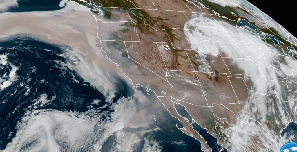
Friday’s visible satellite images show as that a result of the numerous fires, a thick layer of orange smoke is blanketing all of the western and southwestern U.S. Winds have carried some of the smoke well out into the Pacific as well as into the Southwestern U.S. and even into West Texas. The following surreal visible satellite image, captured at 2:10 pm CDT Friday, shows the sad, horrific scene quite well.

NOAA-RAMMB 09-11-2020 2:10 pm CDT
Bob


Social Media