Key Messages
- Isolated to scattered strong to severe storms will be possible across the region this afternoon through tonight
- Large hail (possibly greater than 2 inches in diameter) and damaging winds will be the primary severe weather threats
- There will be a low end chance for a couple of isolated tornadoes
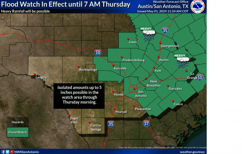
- Locally heavy rainfall and flooding possible—primarily across the eastern Hill Country and Central Texas regions. Here, widespread totals of 1-3 inches are forecast, with isolated totals of 3-5 inches possible
- The National Weather Service has posted a Flood Watch for the eastern Hill Country and all of Central Texas from 3 pm Wednesday through Thursday morning
Discussion
The weather pattern is forecast to become quite active later this afternoon and overnight as an approaching trough of low pressure causes a couple of rounds or rain showers and organized thunderstorms. A mid-morning analysis of the atmosphere across the Hill Country and Central Texas showed an unusually moist and potentially quite unstable situation. Scattered to numerous rain showers and thunderstorms are predicted to form in this environment as the trough approaches our area from the west. Some the storms may organize into supercell thunderstorms—possibly causing large to very large hail and damaging winds. In addition, a couple of isolated tornadoes will also be possible.
The Storm Prediction Center has placed our entire region, with the exception of Matagorda County, under a Slight Risk, or a 2 out of 5 risk, for severe thunderstorms through Wednesday night. Parts of the western and northern Hill Country have been placed under an Enhanced Risk, or a 3 out of 5 risk, for severe thunderstorms. (More on this particular area coming up).
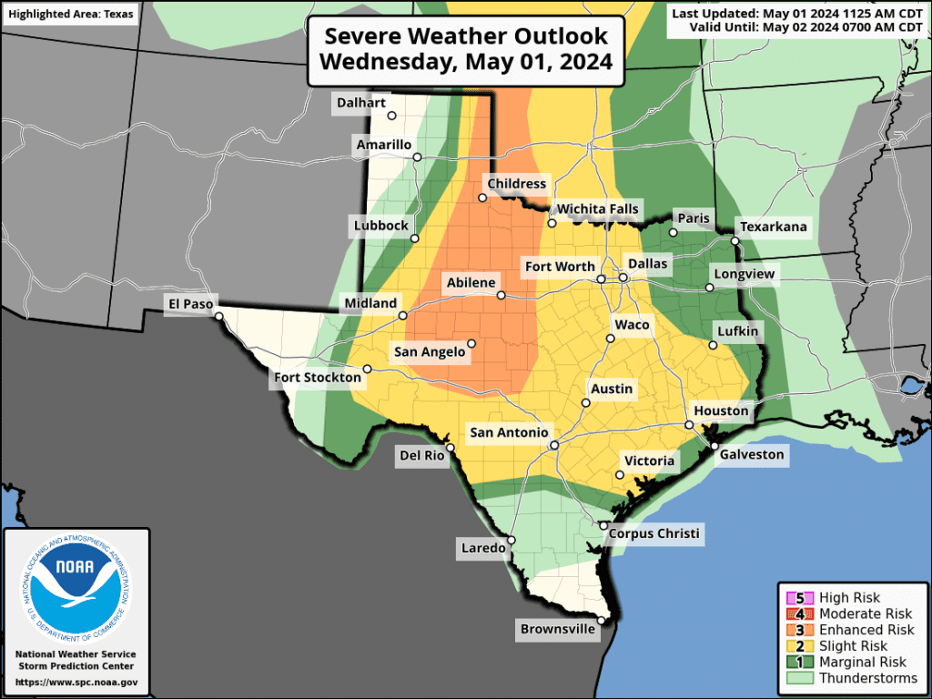
Developing showers and storms are forecast to generally spread from south to north across the area this afternoon and evening.
Today’s rain and storms will also have the potential to produce heavy rain—especially if they slow down or happen to train over a particular area. A very moist, tropical air mass is in place. The heavy rains could possibly cause excessive runoff, resulting in flooding of creeks, streams, and other low-lying and flood-prone locations.
Due to the threat for heavy rain and possible flooding, the National Weather Service has posted a Flood Watch for the eastern Hill Country and all of Central Texas (including the Austin metro) from 3 pm Wednesday through 7 am Thursday.
Forecasters are also closely monitoring West Texas, where a large area of thunderstorms are forecast to develop late this afternoon along the dry line over the area between Midland and Del Rio. High-resolution forecasts call for the area of storms to organize into large complex strong to severe thunderstorms that will track east across the Concho Valley and western Hill Country between about 9 pm and midnight. The complex of storms is predicted to continue marching east across the Hill Country and into Central Texas between midnight and 6 am Thursday. This line of storms will also have the potential to produce large hail, damaging winds, considerable lightning, and heavy rain. The rain and storms are forecast to move off to the east by around or shortly after sunrise Thursday morning.
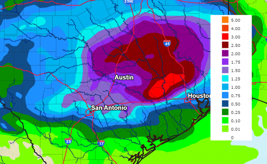
Rain totals this afternoon through Thursday morning are forecast call to generally average between 1 and 3 inches, with isolated totals to near 5 inches possible.
NWS Rainfall Forecast for the Period 7 am Wednesday through 7 am Thursday:
A break from the rain is forecast Thursday morning through Thursday afternoon. However, there will be a slight chance for additional showers and thunderstorms to spread into the Hill Country and parts of Central Texas Thursday evening.
Bob
Social Media