The summer doldrums have begun to settle in. Any remaining hints of our spring weather pattern are unfortunately now gone. Monday’s weather maps showed a broad subtropical ridge, or heat dome, covering the entire southwestern and south central U.S. The heat dome was centered across West Texas. Fortunately, the heat dome so far is not quite as strong as the heat dome we saw last summer.
Forecasts call for the heat dome to remain over our area throughout the week and the upcoming weekend. The center is predicted to be over New Mexico Wednesday through Friday. Sinking air underneath the feature is expected to cause a pattern of sunny, dry, and hot weather at most locations.
One exception to the dry forecast will be across the middle Texas coast this afternoon through mid-week as an area of tropical moisture causes the Sea Breeze to develop and push inland. The Sea Breeze will bring a few spotty rain showers and isolated thunderstorms each day to areas along and south of Interstate 10. The probability for rain at any given location will only be 20 percent. Spotty totals to around a quarter inch will be possible.
- High temperatures Monday and Tuesday are forecast to be in the mid and upper 90s across the Hill Country and Central Texas regions, and in the upper 80s to low 90s across the coastal plains
- High temperatures Wednesday through Sunday are forecast to be near 98-100 degrees across the Hill Country and Central Texas regions, and in the mid-90s across the coastal plains
Peak heat index readings are forecast to be near 105-108 degrees Monday through Wednesday, and between 105 and 110 degrees Thursday through Sunday.
Expect a light southerly breeze at 5-10 mph throughout the week.
Looking out into next week, the forecast solutions are calling for little change in the weather pattern for our region. The center of the heat dome is forecast to shift from the Desert Southwest to the southeastern US early in the week and remain there through late week. While this isn’t expected to bring any significant change to our weather, it should keep high temperatures similar to this week’s levels—mainly in the upper 90s. No widespread triple digit temperatures are predicted at this time. The chance for any rain will be low. However, spotty coastal showers do look to continue.
Tropical Weather Outlook
Weather conditions are currently quiet across the tropical Atlantic. The tropical disturbance in the Bay of Campeche that showed some promise of development late last week never quite came together.
National Hurricane Center forecasters are monitoring a westward-moving tropical wave located a few hundred miles east-southeast of the Windward Islands. This system is producing an area of disorganized showers and thunderstorms. Environmental conditions appear favorable for some slow development once the wave reaches the western Caribbean late this week.
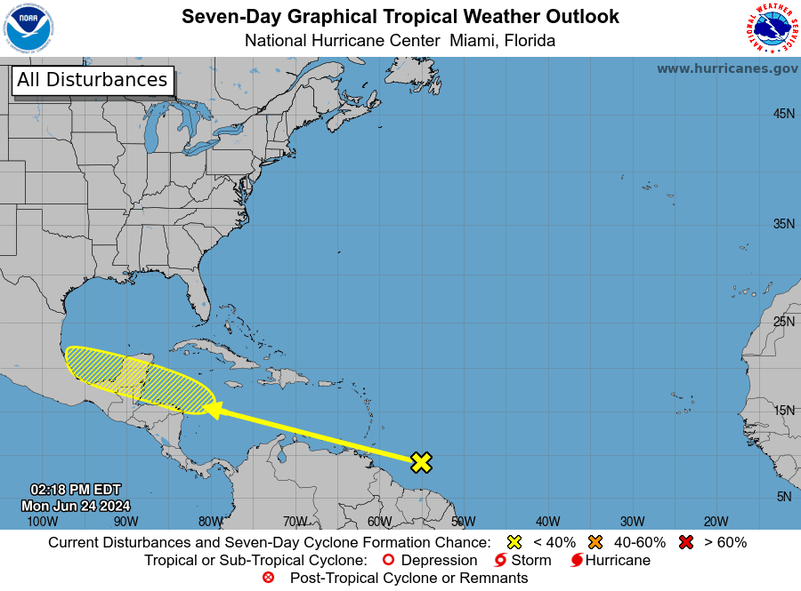
NHC is currently giving this system a low chance, a 20 percent chance, for tropical development over the next seven days.
Latest Sunsets of the Year
Although the summer solstice occurred last Thursday, the latest sunsets of the year will be occurring this week. For the Austin area, the latest sunset will occur on June 29th and 30th.
The latest sunsets come after the summer solstice because the day is more than 24 hours long at this time of the year. For several weeks around the June solstice, the day (as measured by successive returns of the midday sun) is nearly 1/4 minute longer than 24 hours. Hence, the midday sun (solar noon) comes later by the clock in late June than it does on the June solstice. Therefore, the sunrise and sunset times also come later by the clock.
(Courtesy earthsky.org)
Have a good week and stay cool!
Bob
Social Media